
Mapping of the Colonial Pipeline for the NJ Turnpike Widening Project of Exits 6 to 9
Various Locations, New Jersey
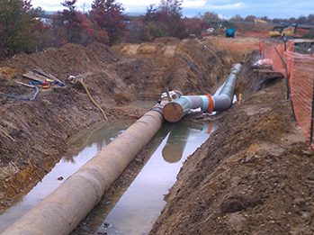
BANC3 provided field surveying and mapping of 35 miles of the Colonial Pipeline, from the Greensboro to Linden Terminal Line, which is being affected by the roadway widening project along portions of the New Jersey Turnpike. BANC3 established horizontal and vertical control utilizing GPS which was referenced to NGS monuments being used on the mapping for the widening project and performed locations of the 30" high pressure pipeline and all surface features and angle breaks at intervals along the tangents. BANC3 developed base maps of all pipeline alignments, fence crossings, secondary roads, markers, signs, utilities, and features for the Colonial Pipeline locations. All plans were prepared in Micro Station format utilizing NJTA CADD standards, referenced to the NJ State Plane Coordinate System NAD 83/NAVD 88.
BANC3's fast response and state of the art technology allowed this surveying and mapping project to be completed ahead of schedule and with no impact on traffic. Accurate locations facilitated in the location and re-alignment design of the pipeline.